
Published December 16, 2024
Exploring the Cape Cod Rail Trail: A Walking Adventure with Friends

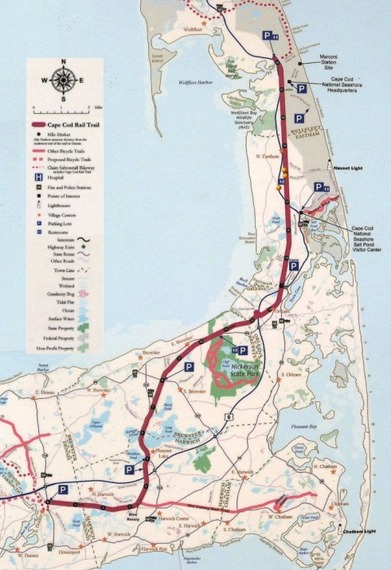
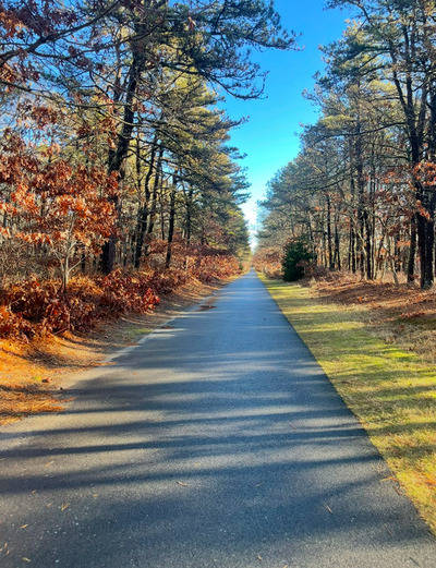
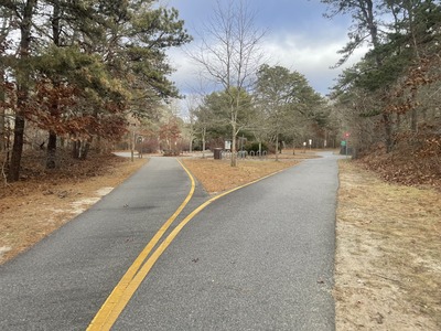
Walking the entire Cape Cod Rail Trail has been an idea of mine for a few months! Stretching from Yarmouth to Wellfleet, this picturesque 25+ mile path winds through some of the most scenic landscapes Cape Cod has to offer. It’s a trail that beckons both locals and visitors, offering a unique way to connect with nature and enjoy the beauty of the Cape.
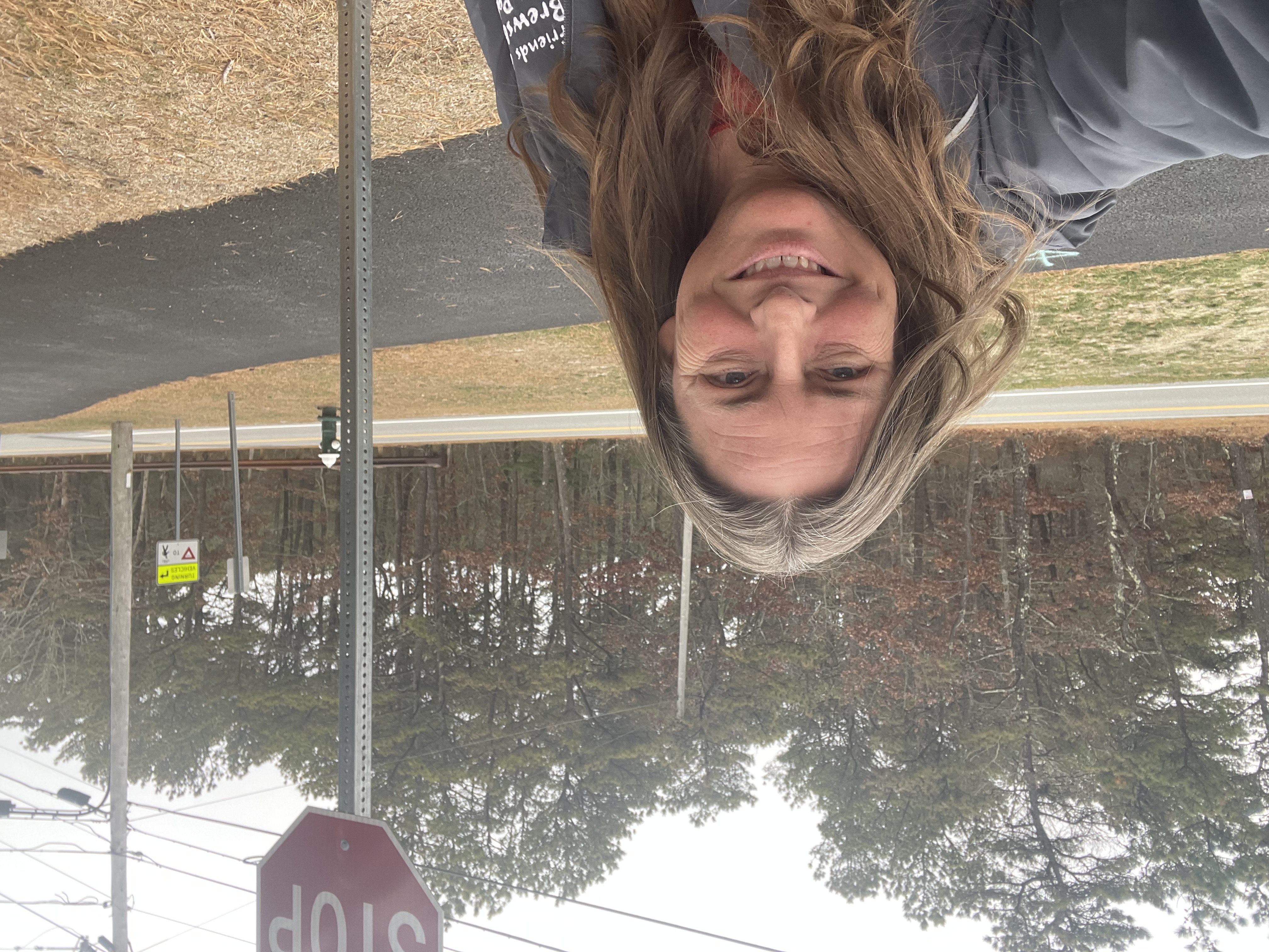
I decided I didn’t want to do this endeavor alone so I created two groups in the Facebook Group Cape Cod Female Friends over 50. However, as I began to research the logistics, I quickly realized there weren’t many comprehensive resources detailing where to park, the distances between parking lots, or how to break the trail into manageable sections. That’s when I decided to create my own plan to make this dream a reality—and to share it with others who might be inspired to do the same!
The Plan: Breaking the Trail into Manageable Segments
To make this journey both enjoyable and practical, I’ve divided the Cape Cod Rail Trail into a series of short walks, each between 2-3 miles up and back. Each walk begins and ends at the same parking lot, making it convenient for participants to park their cars without worrying about arranging transportation..
Weekly Blog Series
I decided that others may want to learn about the plan I put together and to hear about our experiences. So each week I’ll be sharing a blog post detailing that week’s walk. Here’s what you can expect from these posts:
-
Start and End Points: Clear information about the specific section of the trail we’ll be covering, along with the parking lot where the walk begins and ends.
-
Distance: The total mileage for the walk, ensuring it fits into the 2-3 mile range.
-
Trail Highlights: Points of interest, scenic views, or unique features to look out for along the way.
-
Tips and Resources: Any helpful advice, such as where to find restrooms, nearby cafes for a post-walk coffee, or interesting tidbits about the area’s history.
Why This Matters
This project is more than just a personal goal; it’s about building community and encouraging others to explore the Cape in a new way. Whether you’re an avid walker, a nature enthusiast, or simply someone looking for a fun and manageable outdoor activity, this guide will provide all the details you need to enjoy the Cape Cod Rail Trail at your own pace.
Where does the Cape Cod Rail Trail Start and End?!?!
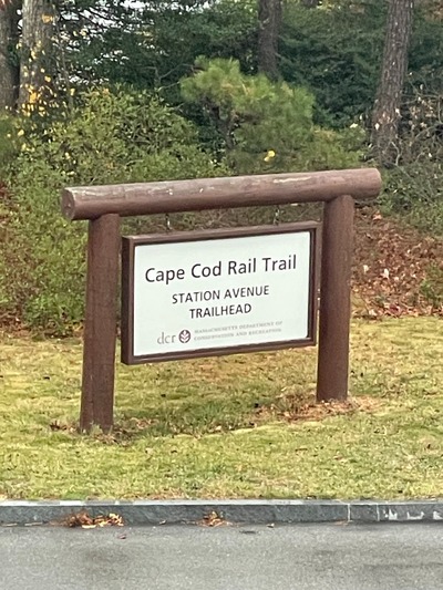
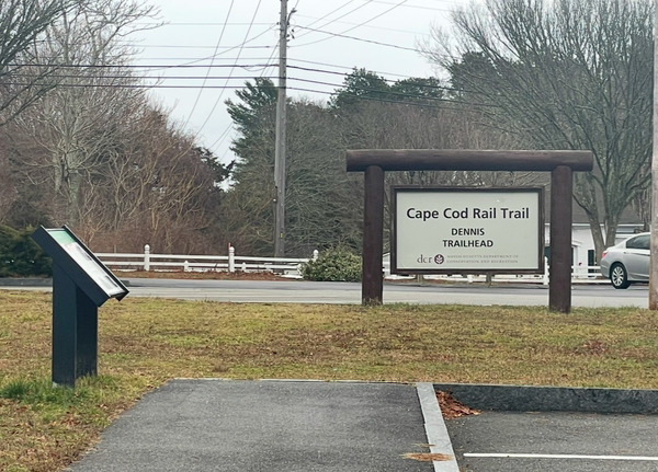
When I started planning the different stages to walk the entire CCRT, I knew I had to include the new expanded section of the Cape Cod Rail Trail (CCRT). If you haven’t heard, this iconic 27.6-mile paved pathway has grown! Originally running from Dennis to Wellfleet, the trail now stretches into Yarmouth, adding over three more miles of scenic goodness.
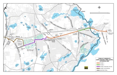
The new Yarmouth section connects Station Avenue to the existing trail in Dennis, making it even easier to hop on and explore.
And guess what? There’s more to come! Plans are in the works to extend the trail even further into Barnstable. You know what that means, right? We’ll have to do another walk when it’s ready!
I’ve split the CCRT into 21 bite-sized segments for this walking series, and I can’t wait to share all the fun details with you as we tackle them. It’s going to be a blast exploring every inch of this Cape Cod treasure.
Curious about the trail and its latest updates? Dive into all the juicy details here: Cape Cod Rail Trail Expansion.
Let’s lace up our sneakers and hit the trail—adventure awaits!
Day One:
Walking the Cape Cod Rail Trail: Our First Adventure Begins!
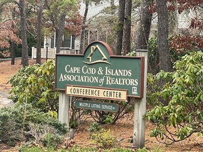
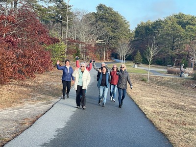
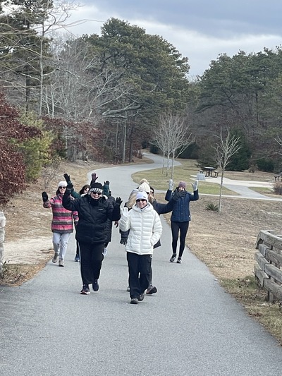
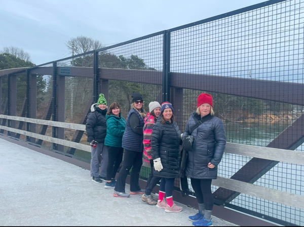
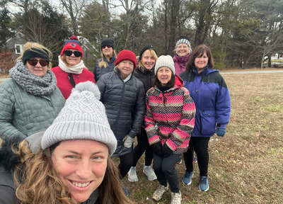
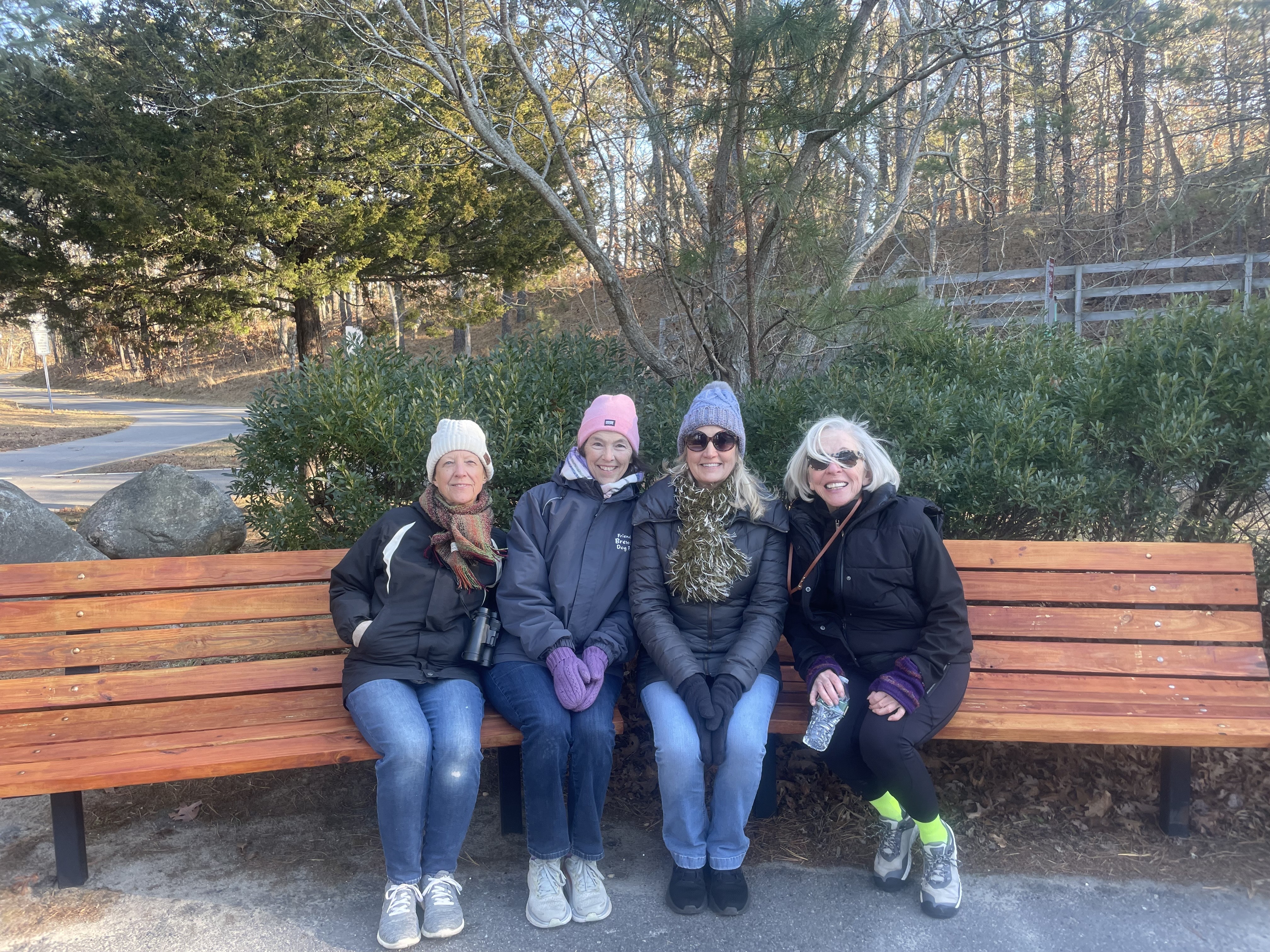
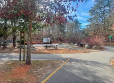
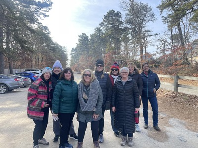
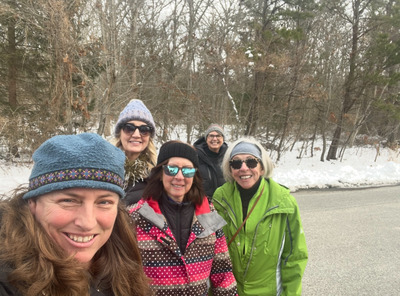
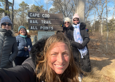
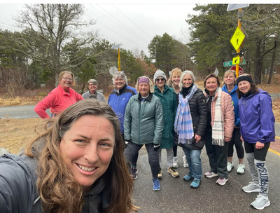
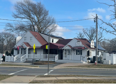
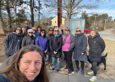
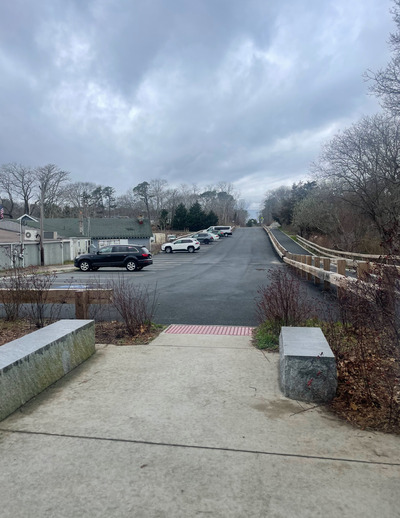
This week, two enthusiastic groups of women set out to conquer the first leg of the Cape Cod Rail Trail (CCRT), an adventure to experience the entire length of this beloved trail. Starting at the Cape Cod and Islands Association of Realtors at 22 Mid-Tech Drive in Yarmouth. We did get permission to park in their parking lot in advance. You can call their office at (508) 957-4300.
The first stage of the trail took us thru the Blueberry Golf Course before we turned around and retraced our steps back to our starting point. We turned around where the trail intersects with Old Town House Road, you will see a parking lot at that intersection. This up and back walk is approximately 2.3 miles and features a flat, serene path winding through the woods and alongside the golf course. The gentle terrain made it an ideal starting point for our journey.
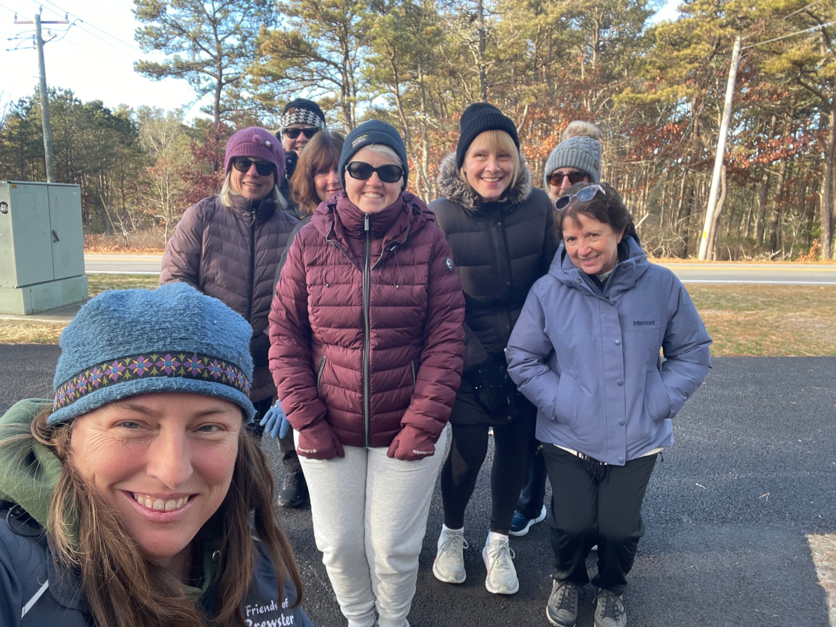
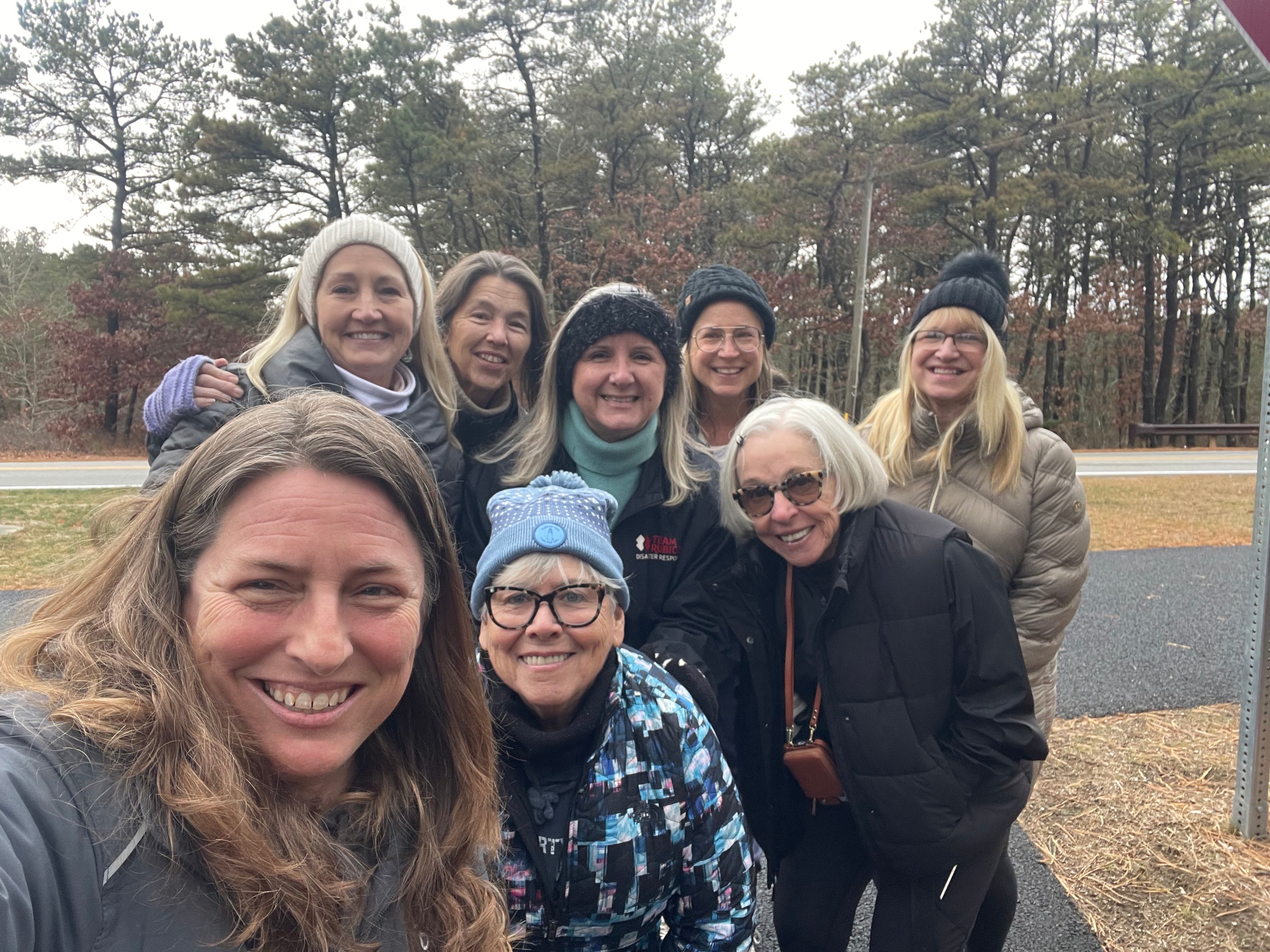
Our two groups brought their own energy to the walk. The Tuesday group completed the route in 47 minutes, while the Saturday group stepped it up, finishing in just 42 minutes. Each group enjoyed lively conversations and plenty of laughs while benefiting from some exercise.
As we look ahead to the next leg of our journey, we’re excited to continue exploring the Cape Cod Rail Trail together. Whether you’re an experienced hiker or just looking to enjoy a beautiful walk, the CCRT offers something for everyone. Stay tuned for updates on our next stages, and we’d love to hear about your own CCRT adventures!
Happy walking!
Day Two:
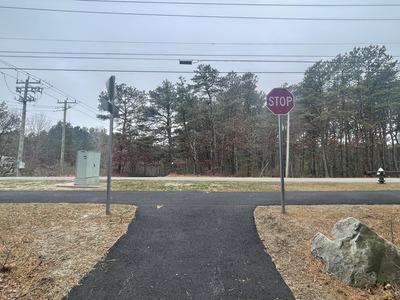
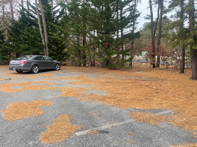
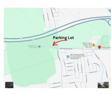
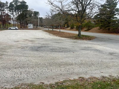
Our two groups tackled the second stage of this awesome trail, starting at the parking lot by Bayberry Golf Course and finishing up at the Station Avenue parking lot. Here’s a quick recap of what we experienced along the way.
Parking and Starting Point
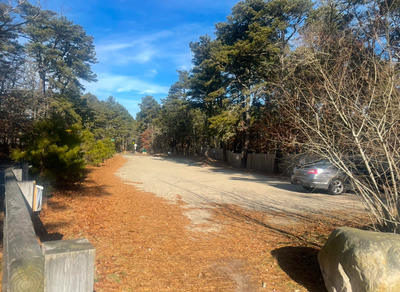
We kicked things off at the parking lot near Bayberry Golf Course, where the trail meets Old Town House Road. There’s no exact address for this lot, but don’t worry—it’s easy to find with a map (look for the arrow!). It’s a great spot to park with plenty of space, and it’s right by the walking path.
The Walk: Nature Meets Local Vibes
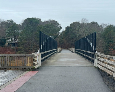
The walk is 2.8 miles long and took one of our groups 56 minutes and the second group did it in 52 minutes. It starts with a few gentle hills to get you warmed up, and near the end, you’ll tackle the Station Avenue Bridge, which has a bit of a slope too. The rest of the route is relatively flat. Along the way, you’ll pass Old Town House Park, which has ball fields and recreational areas. Just a heads-up—make sure to stick to the left when you’re near the park since there are other paths there. The trail also winds past the Yarmouth transfer station and some local commercial and industrial businesses, adding a bit of variety to the scenery.
Wrapping It Up
We wrapped up this stage of the trail at the Station Avenue parking lot. Fun fact: this spot was the original starting point of the Cape Cod Rail Trail before it expanded. It felt great to get our hearts pumping and blood flowing on this walk—a solid mix of exercise and local charm!
Day Three:
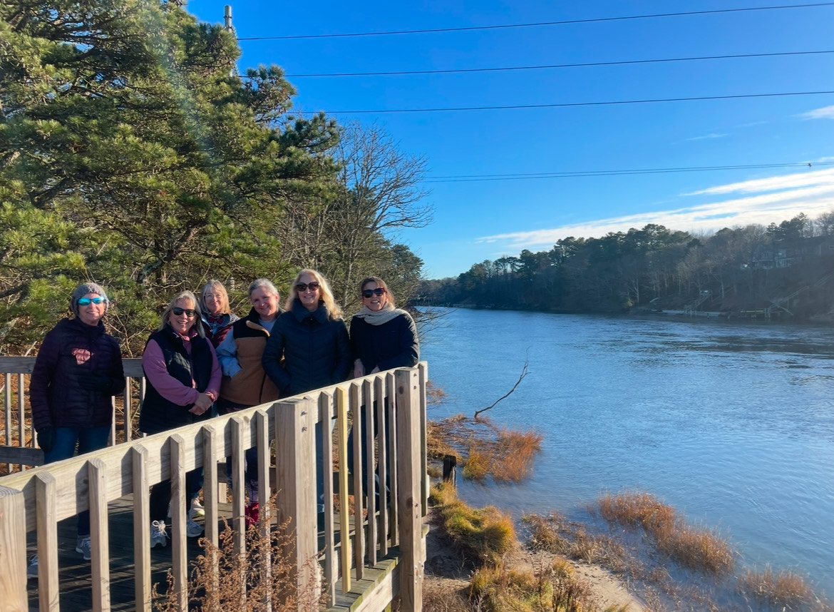
Our walking groups tackled Day Three of our Journey on this beautiful stretch of the CCRT—a 5.4-mile journey filled with natural beauty, local landmarks, and great camaraderie. Here’s a recap of our adventure and everything you need to know to plan your own trip.
Starting Point: The Station Avenue Parking Lot
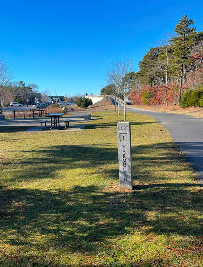
The walk begins at the Station Avenue Parking Lot in Yarmouth. While the lot doesn’t have an exact address, it’s conveniently located by the overpass bridge, next to the Stop & Shop at 474 Station Avenue, Yarmouth, MA, and across the street from Dunkin' Donuts. This lot also marks the official start of the original Cape Cod Rail Trail and features the Yarmouth 1-mile marker, a few picnic tables and benches, and some information about the CCRT.
Trail Highlights
This section of the CCRT offers a mix of wooded serenity, historical touches, and unique sights:
-
Mix of Woods and local Businesses: Most of this walk is wooded with views of the River however, there are some local Businesses that make their appearance especially during the first part of the walk.
-
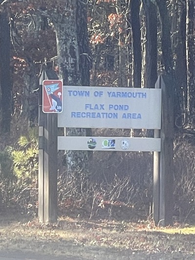
Entrance to Flax Pond Recreation Area: As you make your way, you’ll pass by the entrance to the Flax Pond Recreation Area. While we didn’t explore it this time, it’s a fantastic spot worth visiting for its family-friendly activities.
-
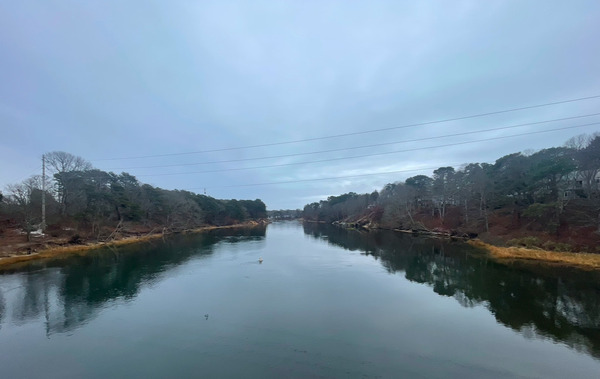
Bass River: One of the trail’s highlights is crossing the Bass River via the George Allaire Bridge. Named in honor of George Allaire, who served as Yarmouth’s Director of Public Works for 22 years, the bridge offers stunning views of the river and surrounding wetlands.
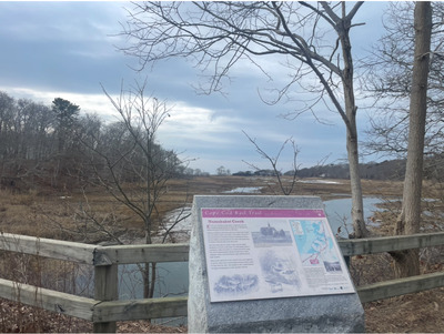
Ending Point: Indian Conservation Parking Lot
The journey concludes at the Indian Conservation Parking Lot in South Dennis. This area is a treasure trove of walking paths that meander through the woods and along the water. If you have extra time, it’s well worth exploring these trails for an extended adventure.
Our Group’s Experience
This 5.4-mile stretch is one of the longer walks on the CCRT, and both our Tuesday and Saturday walking groups completed it in just over an hour and a half:
-
Tuesday Group: 1 hour and 35 minutes
-
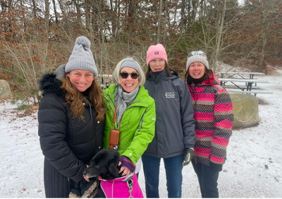
Saturday Group: 1 hour and 36 minutes (with a light dusting of snow to navigate)
The camaraderie, combined with the scenic beauty, made the time fly by. Whether you’re walking solo or with friends, this trail segment offers a wonderful mix of exercise and exploration.
Plan Your Walk
Here are a few tips to make the most of your walk:
-
Parking: Start at the Station Avenue Parking Lot. Use the Stop & Shop address (474 Station Avenue, Yarmouth, MA) as a reference.
-
Gear: Wear comfortable walking shoes and dress in layers, especially during colder months.
-
Explore More: Come back a different day to visit the Flax Pond Recreation Area or the trails near the Indian Conservation Parking Lot.
-
Timing: Allocate about 1.5 to 2 hours for the walk, depending on your pace and any stops you might make.
Whether you’re a seasoned trail walker or a newcomer to the CCRT, the third leg offers an unforgettable journey. So grab your walking shoes, invite some friends, and hit the trail for an adventure you won’t soon forget!
Day Four:
Our Day 4 walk along the Cape Cod Rail Trail brought us to the charming stretch between South Dennis and Harwich. With friends ready for adventure, we set out to explore this 3.3-mile section which includes wooded areas as well as passing by some commercial properties.

Starting Point: Indian Lands Conservation Area, South Dennis
Our walk began at the Indian Lands Conservation Area parking lot in South Dennis. While our main focus was the Rail Trail, this starting point itself is worth a visit. The Indian Lands Conservation Area is a treasure trove of trails, offering historical connections and breathtaking views of the Bass River. If you have time to spare on another day, it’s well worth exploring for a deeper dive into the area’s history and natural splendor.
The Walk: A Blend of Wooded Serenity and Local Activity
The 3.3 miles took both groups around 56 minutes, making for a brisk but enjoyable pace. Early on, the trail leads you across the Route 134 overpass bridge and then goes through wooded areas. There are a few times you will pass by some commercial areas as well as cross over roads. Please be careful on the cross walks as there are a lot of commercial vehicles in this area.
Ending Point: Depot Street Parking Lot, Harwich
Our walk concluded at the Depot Street parking lot in Harwich, which is located near Big Rock Oysters. This is a smaller dirt parking lot.

Day Five:
For Day 5 of our Cape Cod Rail Trail journey, we set off from the dirt parking lot located right next to Big Rock Oysters in Harwich. The closest address to this starting point is 501 Depot Street, Harwich, MA 02645.
Trail Overview
This 4.1-mile roundtrip section took our two groups just over an hour to complete—one group finishing in 1 hour and 11 minutes, and the other in 1 hour and 13 minutes.
Highlights Along the Way
As you make your way along, you’ll pass several cranberry bogs, a quintessential part of Cape Cod’s landscape, especially vibrant in the fall when the berries are in their iconic red hue. The trail also offers a few water views of the marshes and waterways that provide peaceful moments and opportunities to spot local wildlife.

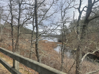
Another highlight of this walk is passing through the Bells Neck Conservation Area, one of Harwich’s natural treasures. The conservation area features expansive salt marshes, creeks, and woodlands.
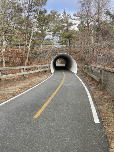
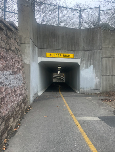
The Tunnel and the Turnaround
As you near the end of this section, you’ll encounter the first "tunnel" on the Cape Cod Rail Trail. This underpass is a fun and unique feature of the route, adding a touch of character to the trail.

The turnaround point for this walk is the Bike Rotary, a hub of activity where multiple trails converge. There are a handful of benches and picnic tables here in case you want to break before heading back.
Day Six:
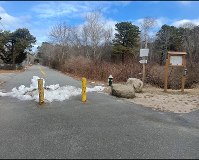
Day 6 of our Cape Cod Rail Trail adventure is the first time that we had to walk in the opposite direction, heading back toward the rotary in the direction of Dennis/Yarmouth. We started from the parking lot at 55 Headwaters Drive, Harwich, MA. There are two parking lots on Headwater and the one you want is the one on the left side of the road where the CCRT crosses Headwaters Drive - NOT the lot on the right side of the road by the cranberry bog.
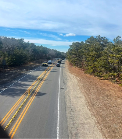
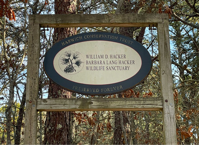
This 2.8-mile stretch offered a beautiful, peaceful walk through the woods of Harwich. It is also the first time on our journey that we cross over Rte. 6. The gentle incline provides an interesting view and perspective of Rte. 6 before leading us back into the tree-lined path. You do pass by The William D. Hacker and Barbara Lang hacker Wildlife Sanctuary that has trails through the woods. No one in our group has ever explored there but was able to find this information online about the trails.
Both of our walking groups kept a steady pace, finishing in 52 minutes and 45 minutes, respectively. As we neared the end, we were rewarded with a scenic view of a cranberry bog before arriving at the rotary. The area features benches and picnic tables, making it a perfect spot to rest and reflect on another successful walk.
Each new section of the Rail Trail brings something unique, and this stretch was no exception. Looking forward to the next adventure!
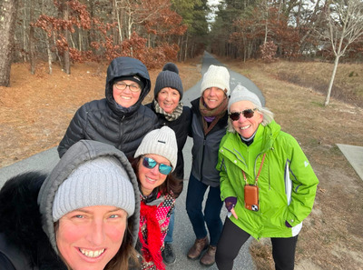
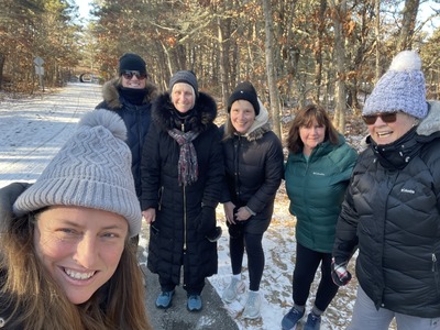
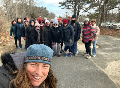
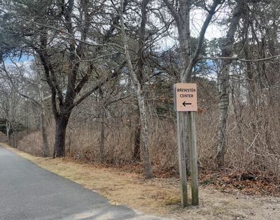
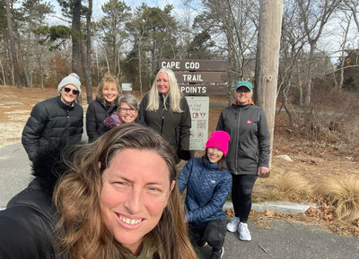
Day Seven:
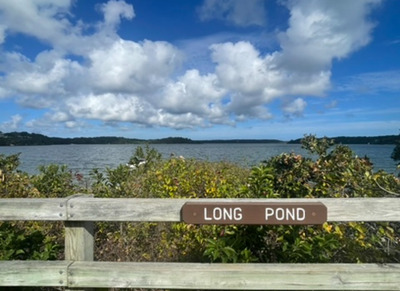
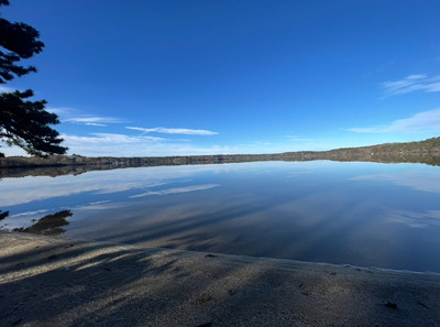
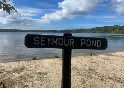
Our Day 7 adventure on the Cape Cod Rail Trail (CCRT) began at the parking lot on Headwaters Drive in Harwich—the same spot where we started Day 6. This time, however, we headed in the opposite direction, making our way toward Brewster. This stretch of the trail is, without a doubt, my all-time favorite and, in my opinion, the most picturesque walk on the CCRT.
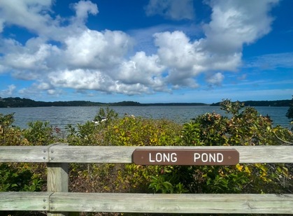
As we strolled along the 3.1-mile route, we passed three stunning ponds: Hinkley Pond, Long Pond, and Seymour Pond. The shimmering water, framed by Cape Cod’s natural beauty, made for a peaceful and scenic walk. Along the way, we also passed a cranberry bog which is always a beautiful sight!
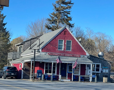
A highlight of this route is Pizza Shark, a fantastic pizza place with an adjoining general store. It’s the perfect spot to take a break, grab a bite to eat, or cool off with an ice cream. If you stop by, don’t miss the disco ball inside—take a moment to have a little dance party! There are also picnic tables available if you prefer to sit and enjoy the surroundings.
Both of our walking groups completed the journey in just under an hour—one in 58 minutes and the other in 59 minutes. This route does require some caution, as you will cross Route 124 multiple times, so be sure to stay alert at these crossings.
Our walk concluded at the parking lot on Route 124 in Brewster, which is located between Crowells Bog Road and Great Fields Road. While there is no specific address for this parking area, it serves as a convenient endpoint for this scenic leg of the trail.
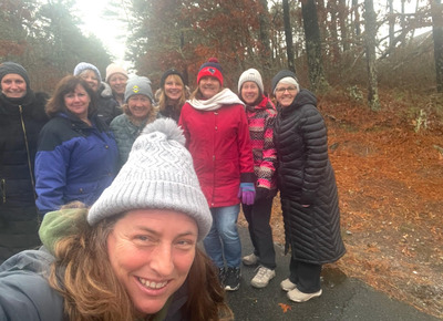
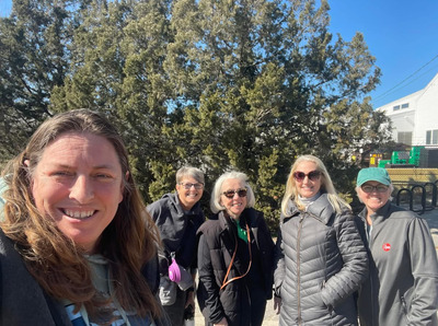
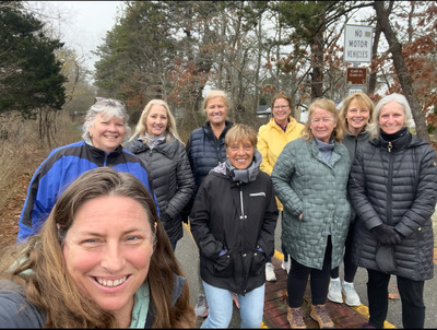
Although we only managed to capture a picture of one of our groups this week, the memories of this beautiful walk will certainly last! If you’re looking for a stunning and invigorating walk on the Cape Cod Rail Trail, this is the one to try.
Day Eight:
Our Day 8 journey on the Cape Cod Rail Trail (CCRT) started at the parking lot on Route 124 in Brewster, nestled between Crowells Bog Road and Great Fields Road. While there is no specific address for this parking area, it serves as a great starting point for a peaceful, wooded walk through Brewster.
This leg of the trail spans 3.5 miles, and our two groups completed it in 59 minutes and 1 hour and 1 minute respectively. The entire route is surrounded by lush woods, making it a serene and shaded path—perfect for those who enjoy nature-filled walks without much road traffic or distractions.
Our walk concluded at the parking lot on Route 137 in Brewster, directly across from Ferretti’s Market. This convenient endpoint offers easy access to refreshments or a quick stop before heading back.
If you’re looking for a quiet, scenic walk through the heart of Brewster’s woodlands, this section of the CCRT is a must-try!
Day Nine:
Our Cape Cod Rail Trail journey continued with Step 9, starting from the parking lot on Route 137 in Brewster, conveniently located across from Ferretti’s Market. This stretch covered 2.3 miles and offered a mix of wooded scenery and glimpses of Brewster’s local businesses and landmarks.
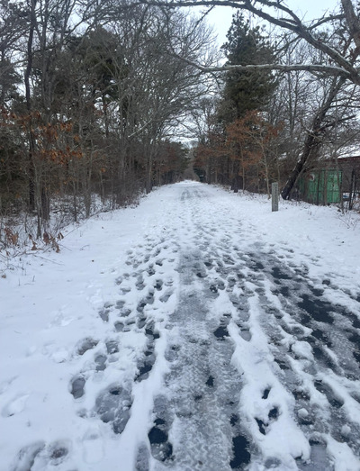
Our two walking groups tackled this route at different paces, with one group completing it in 41 minutes and the other in 52 minutes. The slower time was due to Tuesday’s group having to walk in 1-2 inches of snow with a layer of ice underneath. We made it and yet it took a little extra time.
Though much of this section winds through the woods, we passed by several notable spots that showcase Brewster’s community charm. Along the way, we walked past the pickleball courts, Stony Brook Elementary School, and some favorite local eateries like Stone Lovin’ Pizza and Pico’s Taco Shack. These small landmarks served as familiar waypoints as we moved through the trail.
Our endpoint for this leg was marked by the Brewster Town Center sign, located at the end of Thad Ellis Road. This served as a natural turnaround spot before heading back to our starting point.
Despite the varied conditions, Step 9 of our journey along the Cape Cod Rail Trail was another rewarding experience. Whether blanketed in snow or clear and crisp, the trail continues to offer a perfect blend of nature and community charm. We look forward to the next step in our adventure!
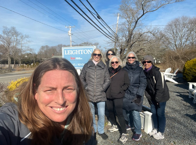
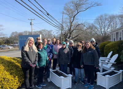
Day Ten:
Our Cape Cod Rail Trail adventure continued with Step 10, beginning from the Leighton Team Real Estate Office at 2672 Main Street in Brewster. From there, we took a short walk down Route 6A and Thad Ellis Road to access the trail. For those looking for a public starting point, an alternative is to begin at the Nickerson State Park parking lot and walk back to the turnaround spot mentioned in Step 9. This means you are walking towards Harwich - not towards Orleans.
A Wooded Path Along 6A
This 3.4-mile stretch of the trail runs mostly through the woods while paralleling Route 6A, offering a peaceful and scenic setting. Despite its proximity to the road, the dense trees create a sense of seclusion, making it a relaxing walk immersed in nature.
Walking Times and Route Details
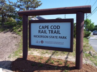
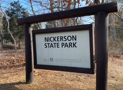
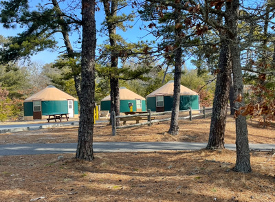
Our two walking groups completed this section in 58 minutes and 1 hour and 3 minutes, maintaining a steady pace. The turnaround point for this walk is at the main parking lot at the entrance of Nickerson State Park.
It’s important to note that as you approach Nickerson, you will pass the first parking lot with three yurts. Keep going until you reach the second parking lot, which is marked by the Nickerson State Park sign and a building with seasonal restrooms.
Day Eleven:
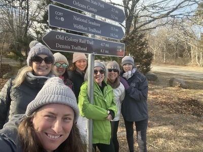
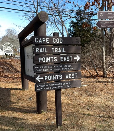
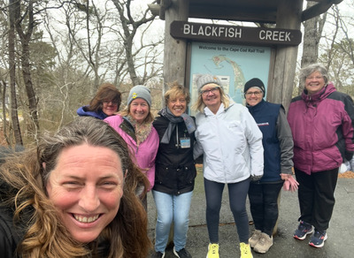
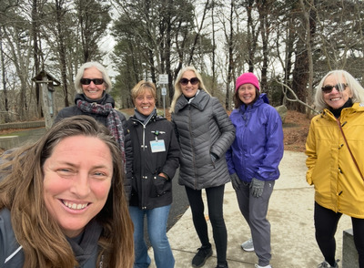
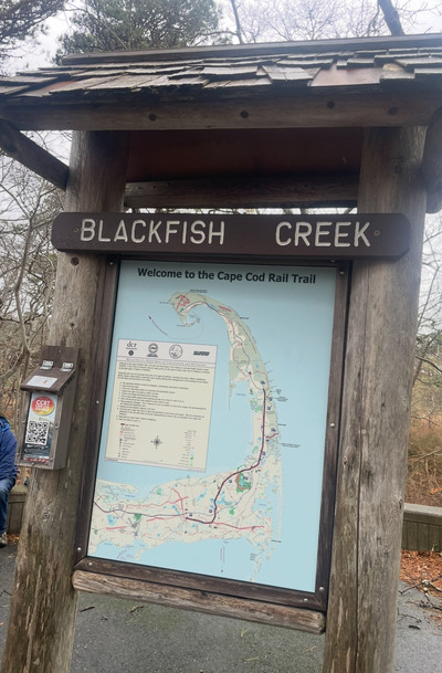
Our journey along the Cape Cod Rail Trail continues with Walk Number 11, a scenic 5.0-mile round trip starting from Nickerson State Park in Brewster and winding its way into downtown Orleans. This route offers a delightful mix of wooded trails, gradual inclines, and a rewarding destination at Hot Chocolate Sparrow—one of the best spots for coffee, pastries, sandwiches, ice cream, and, of course, chocolate! Our two groups completed the walks in 1 hour and 25 minutes and 1 hour and 23 minutes!

.jpeg)
The Route
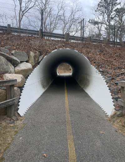
Beginning at Nickerson State Park, the trail immediately immerses you in a peaceful woodland setting. As you head east toward Orleans you’ll pass through a tunnel under Route 6A. You will notice a slight incline as you continue to Orleans—a steady but manageable ascent. Further along, you'll cross an overpass above Route 6, offering an interesting perspective of the highway below. There is a section of the trail where you must walk on the road. It’s well-marked with signs, so just follow the directions, and you'll be back on the designated path.
The turn around for this walk is the parking lot near Hot Chocolate Sparrow, an iconic Cape Cod café loved by locals and visitors alike. Whether you’re in the mood for a warm cup of coffee, a delicious pastry, or a sweet treat to celebrate your trek, this is the perfect place to relax before heading back to Nickerson State Park.
Final Thoughts
This walk is a wonderful mix of nature and small-town charm, making it a great option for those who enjoy a bit of elevation change and a rewarding destination. The wooded sections provide a serene experience, while the transition into Orleans offers a glimpse of Cape Cod’s vibrant local culture. If you’re looking for a scenic and satisfying walk along the Cape Cod Rail Trail, this one is definitely worth adding to your list!
Day Twelve:
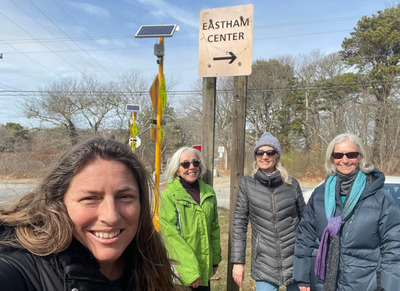
Cape Cod Rail Trail Walk – Day 12: Orleans to Eastham
Our journey along the Cape Cod Rail Trail continued with Walk Number 12, a 4.1-mile round trip walk starting in the heart of Orleans and turning around at the intersection with Governor Prence Road in Eastham. With two groups setting out on this adventure, both completed the walk in just over an hour—one in 1 hour and 12 minutes, the other in 1 hour and 10 minutes. It was a brisk yet scenic trek through some of the trail’s most diverse landscapes.
We began our walk at the large dirt parking lot across from the well-loved Chocolate Sparrow. This central location in Orleans offers a convenient place to start, with easy access to coffee and treats for a little pre-walk fuel. From here, we stepped onto the trail, eager to experience the variety of scenery along the way.
The first section of this walk took us through a wooded area. During the walk we passed the Orleans District Courthouse as well as crossing over Route 6. As we continued, the landscape opened up, and we found ourselves walking past stretches of marshland.
Our turn around point is at Governor Prence Road in Eastham. With another section completed, we’re looking forward to what’s ahead on this adventure across Cape Cod. Each walk brings new sights, new experiences, and a deeper appreciation for this beautiful region. On to the next stretch!
Day Thirteen:
Walk 13 marked the shortest stretch of our Rail Trail journey so far, covering just 1.8 miles. Despite its brevity, this walk was filled with natural beauty and offered a peaceful, wooded route passing by Herring Pond. Our two groups completed the walk in 32 minutes and 30 minutes, keeping a steady pace as we made our way through this serene section of the trail.
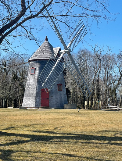
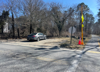
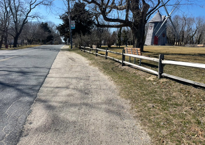
The starting point for this walk was on Samoset Road in Eastham, where a very small parking lot with just 3-4 spaces is available near 315 Samoset Road. Given the limited parking, an alternative option is to park near the Eastham Windmill along the fence line and walk approximately 0.3 miles to the trailhead.
Unlike our previous walks, we tackled this section in the reverse direction, making our way toward Governor Prence Road in Eastham. The familiar endpoint from Walk 12 now served as our turnaround spot, giving us a new perspective on the path we had previously explored.
Despite being the shortest leg so far, Walk 13 offered a refreshing change of pace. The wooded scenery and quiet surroundings made for a pleasant, leisurely trek. With another section completed, we’re eager to continue uncovering more of the Cape Cod Rail Trail, one walk at a time!
Day Fourteen:
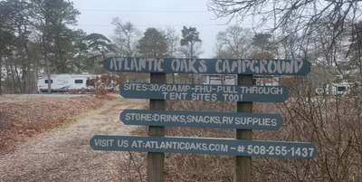
Walk Number 14 took us through one of the more iconic stretches of the Cape Cod Rail Trail, starting from the Nauset Road parking lot in Eastham—right next to Nauset Canine—and heading southbound back toward Orleans. This was one of our longer treks, coming in at 4.9 miles, and it delivered a fun, peaceful, and genuinely interesting experience from start to finish.
Throughout the walk gives off those classic Cape Cod vibes. We passed by a handful of Eastham landmarks that locals and visitors alike will recognize—Arnold’s Clam Shack (a must-stop in summer), the long-standing Willy’s Gym, Atlantic Oaks Campground and a collection of old-school Cape-style motels that are frozen in time in the best way.
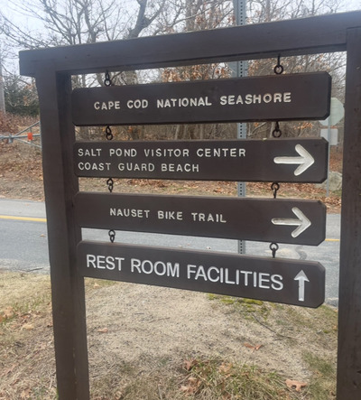
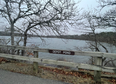
You will also go through a tunnel under Route 6, which feels like a bit of an adventure in itself, and from there you begin to hit some of the prettier water views. You pass by both Great Pond and Depot Pond, two peaceful bodies of water that offer a little nature moment as you cruise by. Between the vintage roadside attractions and quiet pond views, there’s a great contrast of energy along this route. Another great feature of this walk is the opportunity to take a short detour off the Cape Cod Rail Trail and visit the Salt Pond Visitor Center, part of the Cape Cod National Seashore. It’s just a brief walk and well worth the stop.
We wrapped up this walk at the Samoset Road parking lot in Orleans. Both walking groups made great time—one clocked in at 1 hour and 22 minutes, and the other just a minute faster at 1 hour and 21 minutes. Not bad for nearly five miles!
This stretch is a great mix of nostalgic charm, nature, and tranquility—definitely one to add to your list if you’re looking to experience a little bit of everything Cape Cod has to offer on foot.
Day Fifteen:
Walk 15 marked a special milestone in our journey along the Cape Cod Rail Trail—we officially entered the town of Wellfleet, the final town along the CCRT! Starting from the familiar parking lot on Nauset Road in Eastham (right next to the Nauset Canine Club, as we did for Walk 14), this time we headed forward on the trail, in the direction of Provincetown.
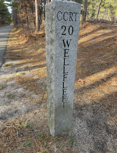
This 3.6-mile stretch is a peaceful, wooded walk that winds through classic Cape Cod landscapes. We passed by a number of tucked-away homes and several old-school Cape motels, the kind that make you feel like you’ve stepped back in time. The trail here is serene and shaded, making it a great walk for anyone craving a quieter slice of the Cape.
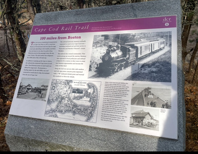
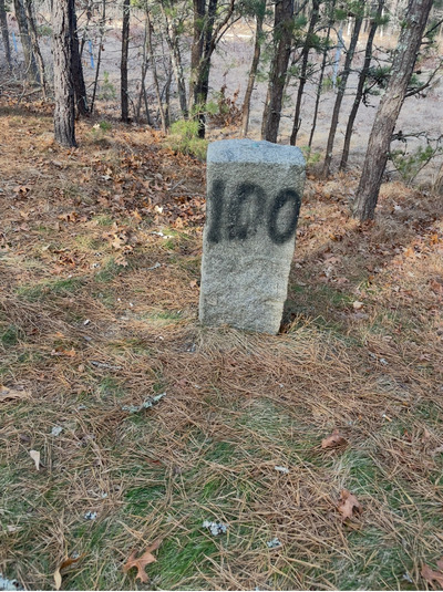
One particularly neat highlight on this walk is the 100 Mile Market—a marker that represents the 100-mile point from Boston on the original railway. It's a small but meaningful nod to the CCRT's rich history, and a great little photo op along the way.
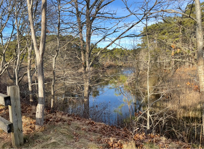
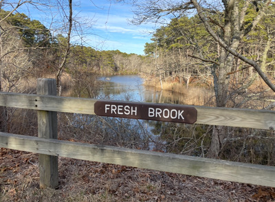
Our turnaround point was at the Fresh Brook sign—at which point you’ll actually see Fresh Brook itself! It’s a pretty, peaceful spot and a nice natural marker to pause and take in the scenery before heading back.
Our two walking groups made good time again, finishing in 1 hour and 3 minutes and 59 minutes respectively. Not bad for a casual 3.6-mile stroll through the woods of Eastham into Wellfleet!
This section of the trail is all about quiet beauty, nostalgic Cape charm, and historic touches—it’s a wonderful way to experience the northern end of the Rail Trail.
.jpeg)
Day Sixteen:
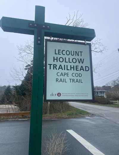
Walk 16 took us deeper into the peaceful, wooded beauty of Wellfleet, starting from the parking lot on LeCount Hollow Road. This time, we walked in the opposite direction, heading back toward Orleans.
This 3.5-mile walk winds through a quiet, shaded stretch of the Cape Cod Rail Trail. It’s a mostly wooded route, with glimpses of nearby homes, a peaceful cemetery, and a look at the new Wellfleet Town Offices along the way. While most of the trail is flat, this section offers a few small hills to keep things interesting, adding a bit of variety to the otherwise gentle terrain.
Our turnaround point was once again the Fresh Brook sign, where you can spot the brook itself—still as calm and pretty as ever. It’s always a nice visual landmark to signal a halfway point and a good moment to pause and enjoy the surroundings.

Our two walking groups cruised through the walk with solid times of 59 minutes and 1 hour and 1 minute. A great pace for a morning out on the trail!
And of course, no walk in this part of Wellfleet would be complete without a visit to the nearby PB Boulangerie Bistro. Our Saturday group took full advantage of the bakery’s close proximity and treated themselves to some post-walk pastries and coffee—because what’s better than fresh croissants after a morning hike?
This walk had it all—shade, serenity, a bit of history, and the sweet reward of a French bakery at the finish line.
Day Seventeen:
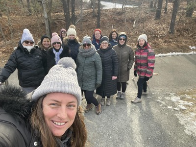
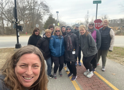
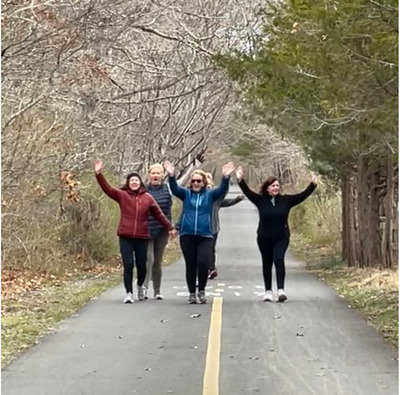
We made it! After months of walking, talking, and taking in the natural beauty of the Cape, we’ve completed our final walk on the Cape Cod Rail Trail. Day 17 came with mixed emotions—accomplishment, joy, and just a little bit of sadness that our weekly tradition is drawing to a close.
This final leg of the journey started at the parking lot on LeCount Hollow Road in Wellfleet. It’s a short and sweet walk—just 1.6 miles round trip—but packed with the same peaceful charm we’ve come to love. The trail meanders through a quiet stretch of woods, and you definitely know when you’ve reached the end: a simple green sign that clearly marks it with a single word—“end.”.jpeg)
This week, in a perfect way to wrap up the series, our two walking groups joined forces and walked as one. Sharing this last walk together made it even more special. It was a brisk 27-minute stroll, full of conversation, laughter, and a touch of reflection..jpeg)
.jpeg)
To celebrate the completion of our Rail Trail adventure, the whole group headed over to PB Boulangerie afterward for some well-earned coffee and snacks. Sitting together, sipping coffee and enjoying a few treats, we looked back on how far we’d come—not just in miles, but in memories made and friendships deepened..jpeg)
Though the walks may be over for now, the connections we’ve built and the joy we’ve found on the trail will stick with us. Thank you to everyone who joined along the way—whether for one walk or all seventeen. Here's to the journey, the community, and whatever the next trail may bring..jpeg)
Until then, happy walking! 🚶♀️🚶♂️☀️
|


or another way